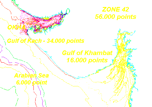
*** ZONE 42 - DATA ***
UTM Zone42 - covers Gulf of Kach & Gulf of Khambat -
from several Amiralty charts
Futher detailed data near Okha area - Total - Shorelines, isles and depth =
56.000
points
Back to
HOME
---
HOME-with-frame
---
Back - Gulf of Kach
---
Next - D-Synergie